Navigation


Tour de Greenbelt Routes & GPS App
Route Marking Info
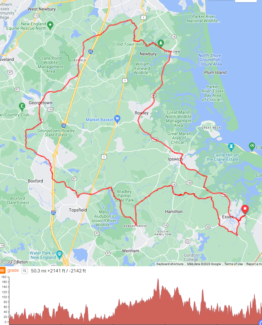
The 50- and 25-mile road routes will be lightly marked with arrows at turns, but you will navigate the course using the free Ride with GPS event turn-by-turn navigation. It works just like the GPS in your car— showing your location on the map on your phone screen and announcing upcoming turns with audio and on-screen cues. You will need a fully charged phone and a place to mount it on your bike.
The Gravel Grinder routes will not be marked, but will have free Ride with GPS event turn-by-turn navigation for your phone. There is one route with more advanced riding of about 40 miles and another shorter route at around 29 miles.
Many thanks to our volunteer route-builders: Dan Tieger, Noah Leavitt, Charlie Mann and Brad Westbrook!
All Route Maps and Navigation
Navigation App
***2026 Routes Coming This Summer***
Greenbelt provides the Tour de Greenbelt routes via the Ride with GPS app. We host the ride as an “Event” within their system so that you can access all the premium features, like Turn by Turn navigation and audio cues, for free during the ride. You will just need a free Ride with GPS account to access it. You DO NOT need to pay for the premium subscription to access the routes as long as you go through the invitation link we provide!
Instructions for downloading the route and using the Ride with GPS App
(If you prefer to load the route into your own device or a different app, see “Advanced GPS Users” section below.)
To see the 2025 Turn by Turn Navigation Routes, using the free Ride with GPS app, create an account, download the app, and click this link while on your phone:
https://ridewithgps.com/auto_approve/Event/397507/tGX6eNPjdfOXUEuPlxeVJiBEjessju5a
Advanced GPS Users
2025 routes:
The raw .FIT and .GPX files, if you wish to use your own GPS device:
Navi files (updated 9/15/25)
We will also check them over the week before the event, so if you download it early, please watch for an email with any last minute changes (trails washed out, road construction, flooding detours...) and be prepared to replace any outdated info with the new route.
If you already know the routes and want to report an issue, please let Jane know!
Questions? Contact Jane Rumrill
Questions About Tour de Greenbelt
- Routes/Logistics
ecga@ecga.org
Attn: Jane Rumrill - Fundraising/Sponsorship Questions
ecga@ecga.org
Attn: Anna Fletcher - Jersey Ordering Questions
ecga@ecga.org
Attn: AnnMarie Gallivan - Volunteering
volunteer@ecga.org